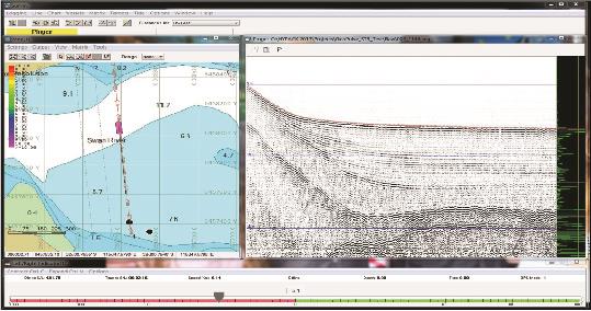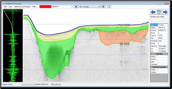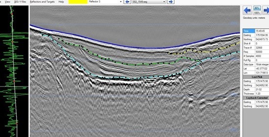
HYPACK Sub-bottom을 산업용 견고한 워크스테이션에 통합하여 해양 지구 물리학적 운영 환경을 위한 일체형 데이터 수집 및 처리 소프트웨어 패키지를 제공합니다.
HYPACK Sub-bottom은 해양 지구물리학, 엔지니어링 및 지질 기술 현장 조사, 준설, 채굴 응용 분야을 위해 설계된 Sub-bottom Profiling (SBP) 소프트웨어 패키지입니다. 본 소프트웨어 패키지는 모든 Sub-bottom 프로파일링 요구 사항을 충족하기 위한 간편하고 사용하기 쉬운 솔루션입니다. HYPACK 소프트웨어는 먼저 프로젝트 측지 (geodesy)를 정의하고 수심 측량 하드웨어를 구성하고 배경 차트 (ENC 및 웹 맵)를 가져오며 측량 라인을 계획한 다음 측량 프로그램을 시작하여 데이터를 획득하는 몇 가지 기본적인 단계를 수행하여 구성하기에 직관적입니다. 측량 프로그램 내에서 SBP 시스템을 추가로 구성하고 조정할 수 있습니다.
HYPACK Sub-bottom 소프트웨어 특징

- HYPACK Sub-bottom supports numerous SBP systems, both analogue and digital
- Hull-mounted systems require only a simple GPS. For towed systems, HYPACK supports multiple cable counters and performs layback calculations or USBL/LBL acoustic positioning can be utilised
- A sophisticated triggering system enables simultaneous acquisition of two different SBP systems with no acoustic interference between the systems
- Real-time view of all sensor data
- Display options include unipolar vs bipolar displays and controls for colour together with band-pass filtering and TVG
Processing

- Loads large datasets.
- Supports SEG-Y and JSF data formats. Reads most third-party SEG-Y files.
- Digitize layers, pick targets and export to ASCII files.
- Apply gain (automatic and user-defined TVG) & band pass filtering.
- Bottom tracking and swell correction.
- Adjust sound velocity in water and sediment.
- Apply HYPACK tide files.
- View SBP data and interpretations in a 3D fence diagram.
Exporting Data and Final Products
- DXF file with layer information.
- Export All Format files.
- Export XYZ ASCII data for all reflectors.
- Export fence diagrams for 3D view of data.
- Plot data in HYPLOT.
Resources
Hypack SBP Workstation Datasheet

